

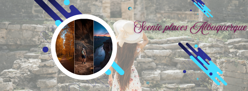
Top Scenic Places in Albuquerque That Cost Nothing to Visit
Albuquerque has a specific relationship between scenery and access that most American cities of its size do not have: the most visually dramatic places in the city are free. The mountain, the river, the ancient petroglyphs, the volcanic landscape, the cottonwood forest — none of them charge admission. They are available to everyone, every day, at any hour the weather allows.
This is not accidental. The city has more parkland per person than any other city in the United States, as confirmed by the Visit Albuquerque official scenic places guide. The result is a scenic landscape that is genuinely, remarkably accessible — 2,650 acres of Sandia foothills open space, 16 miles of bosque trail, multiple petroglyph monument access points, and free viewpoints distributed across the city from the West Mesa plateaus to the river's edge to the foothills' edge.
This guide covers Albuquerque's best scenic places organized by the type of visual experience each provides — the ancient and geological, the river and forest, the elevated viewpoint, the historic and cultural. Each includes the specific access details, the best time of day or year, and the photography notes that help first-time visitors capture what makes each location worth the trip.
⚠️ 2026 Access Update — Sandia Crest Road
Before planning any visit to the upper Sandia Mountains via the road: the Sandia Crest Scenic Byway (NM Highway 536) is currently closed beyond mile marker 11 through fall 2027 for improvement projects. The Ellis Trailhead and the Sandia Crest Recreation Site are inaccessible by road during this period. The Sandia Peak Aerial Tramway continues to operate normally (admission required — not covered in this free guide). All foothills trail access below the Tramway elevation remains fully open and free.
The Ancient and Geological Scenery — Where History Is Carved Into the Earth
Petroglyph National Monument — Rinconada Canyon
Access: Free | Parking: Free | Trail: 2.2-mile loop | Best time: Early morning or late afternoon for best light on petroglyphs
Rinconada Canyon is the free, fully accessible Petroglyph National Monument trail where 700-year-old images carved into volcanic basalt are visible for the full length of a 2.2-mile loop trail. The images — spirals, bighorn sheep, human figures, hand prints, clan symbols, and geometric designs — were pecked into the black basalt by Pueblo people and their ancestors between approximately 1300 and 1700 CE.
The scenic quality of Rinconada Canyon is specific: the black volcanic escarpment is not a cliff or a canyon in the dramatic landscape sense — it is a long, low wall of volcanic rock at the western edge of the city, with the volcanic cinder cone fields visible to the north and the high desert stretching to the horizon. The scale is intimate, the imagery is at eye level, and the combination of ancient human mark-making in a specific geologic landscape produces an encounter with time that is available at no cost.
- Photography note: The petroglyphs are best photographed in the hours after sunrise and before sunset, when the low-angle light creates contrast between the dark basalt surface and the lighter pecked images. Midday flat light makes the images harder to distinguish. Arrive at dawn for the best conditions.
- Access: From I-40, exit at Unser Blvd, go north approximately 3 miles to Rinconada Canyon Road (St. Joseph's Ave). Free parking at the trailhead.
Petroglyph National Monument — Piedras Marcadas Canyon
Access: Free | Parking: Free | Trail: Approximately 1.5 miles | Best time: Weekday mornings for solitude
Piedras Marcadas Canyon is the most peaceful of the monument's free hiking areas — less visited than Boca Negra and Rinconada, with a flat accessible trail through the volcanic terrain and petroglyphs visible throughout the walk. The canyon's lower visitor volume produces the specific encounter with the ancient images that is harder to access on weekends at the more popular areas.
The Piedras Marcadas trail also produces some of the monument's best wildlife viewing: roadrunners are commonly seen on the trail (including the specific surprise of watching a roadrunner move fast enough to startle — they are significantly larger and faster than cartoon versions suggest), and coyotes are occasionally visible in the early morning and late afternoon hours.
The Petroglyph Volcano Day Use Area — Five Ancient Cones for Free
Access: Free | Hours: 9am-5pm daily | Location: Off I-40 exit 149 (Atrisco Vista Blvd), then north to Buena Vista Dr
The Petroglyph National Monument's Volcano Day Use Area provides free access to the base and slopes of the five extinct volcanic cinder cones that erupted between 150,000 and 190,000 years ago and whose lava flow created the black basalt escarpment containing the petroglyphs. For the scientifically curious visitor, the volcanoes are the geological origin story made physically accessible.
Standing at the base of a cinder cone and looking east toward the Sandia Mountains — which rose through a completely different geological process, thrust up along a fault line to expose 1.4-billion-year-old Precambrian granite — produces the specific experience of seeing three geological eras simultaneously in one view. West: extinct volcanoes 150,000 years old. Below: the Rio Grande floodplain, current and ongoing. East: the Sandia granite, 1.4 billion years old. This multi-era geological panorama is available from the Volcano Day Use Area at no cost.
The River and Forest Scenery — The Rio Grande Bosque
The Paseo del Bosque Trail — 16 Miles of Free Cottonwood Forest
Access: Free | Length: 16 miles paved | Best time: October for cottonwood color; dawn year-round for wildlife
The Paseo del Bosque Trail is the primary free scenic experience in Albuquerque — 16 miles of paved multi-use trail through the Rio Grande cottonwood forest that runs north to south through the city. The trail provides access to a riparian forest ecosystem that is one of the most biologically productive habitats in the American Southwest, visible throughout from the flat, accessible paved surface.
The bosque's specific scenic value peaks in October when the Fremont cottonwoods turn the specific gold that makes the valley's photographers and painters return annually. "The Paseo del Bosque Trail offers an ideal multi-use path along the lush banks of the Rio Grande. Whether you're walking or biking, this trail allows you to indulge in the natural beauty that defines Albuquerque's landscape," confirmed the SMART Landscape Albuquerque budget activities guide (February 2026). The trail is free, paved, flat, and accessible from multiple parking areas throughout the city.
The year-round bosque wildlife viewing calendar:
- Year-round: Great blue herons, beavers, painted turtles, muskrats, and a rotating cast of songbirds occupy the bosque's permanent population.
- November through February: Sandhill cranes stage in the South Valley section during migration. Thousands of individuals in the pre-dawn roosting groups produce one of the most dramatic free wildlife experiences available to any American city.
- Spring: Migratory songbirds moving through the bosque corridor — yellow-rumped warblers, Wilson's warblers, and the occasional vagrant species — attract birders from across the region.
- October: Peak cottonwood gold color. The single best visual week of the Albuquerque year for the bosque, with no cost for access and no crowds at the early morning hours.
Tingley Beach — Waterfowl, Fishing Ponds, and Bosque Edge Scenery
Access: Free to visit and walk | Location: 819 Tingley Drive SW (adjacent to the Paseo del Bosque Trail and ABQ BioPark)
Tingley Beach's stocked fishing ponds, boardwalk, and bosque-edge character produce a landscape that is specifically serene in the early morning hours — the waterfowl (Canada geese, ducks, herons, grebes) moving on the still water, the cottonwoods visible behind the ponds, and the sound of the city not yet present at 7am. The ponds have a floor-to-ceiling glass aquarium window visible from the Rio Grande Nature Center adjacent to Tingley, accessible with the $3 vehicle fee, which shows the underwater world of the pond ecosystem.
For families with young children, Tingley Beach is the free outdoor experience that most consistently produces the specific quality of childhood wonder — a turtle on a log, a blue heron standing still at the pond's edge, a duck leading ducklings across the water — that no indoor attraction replicates.
Rio Grande Nature Center State Park — $3 Vehicle Fee, Genuinely World-Class
Access: $3 vehicle fee (not technically free, but close enough to include) | Location: 2901 Candelaria Rd NW | Best time: Dawn for bird watching
The Rio Grande Nature Center State Park's $3 vehicle fee buys access to 270 acres of Rio Grande bosque habitat with the floor-to-ceiling glass viewing windows into the bosque wetland — the most intimate wildlife viewing infrastructure available in any Albuquerque green space. The glass-walled observation room overlooks a pond where turtles bask, herons stand, and the bosque ecosystem operates in a state of accessible display.
The Nature Center's interpretive programming and birding infrastructure make it the best single location in Albuquerque for the visitor who wants to understand what they are looking at in the bosque, not just see it. The docent staff on weekend mornings can identify every bird species present and explain the ecological relationships visible through the observation windows. At $3, it represents one of the best experiences-per-dollar in the city.
The Elevated Viewpoints — Where Albuquerque Becomes a Painting
West Bluff Park — The Best Free Sunrise Viewpoint in the City
Access: Free | Location: West side of the Rio Grande, access via El Aguila Pl off Dennis Chavez Blvd | Best time: Sunrise
West Bluff Park is Albuquerque's most underappreciated free viewpoint — an elevated plateau on the west bank of the Rio Grande that provides a simultaneous view of the Rio Grande directly below, downtown Albuquerque across the river, and the Manzano Mountains in the distance to the southeast. Multiple benches have been placed at the park's viewpoints specifically for extended scenic enjoyment.
The sunrise view from West Bluff Park is the specific recommendation: the park faces east, meaning the Sandia Mountains light up directly in the line of sight as the sun rises behind them. The city illuminating between the observer and the mountains, with the Rio Grande in the immediate foreground, produces the specific Albuquerque dawn composition that photographers specifically travel to capture. Free, accessible, and with free parking at the trailhead.
Sandia Foothills Open Space — Elena Gallegos and the Foothills Trail Network
Access: $1 vehicle fee on some days at Elena Gallegos; free on foot or bicycle from Northeast Heights residential streets | Location: 7100 Tramway Blvd NE for Elena Gallegos
The Sandia Foothills Open Space's 2,650 acres provide the most accessible elevated viewpoints of Albuquerque available at any price point. The elevation range from 5,720 to 6,800 feet puts hikers at least 500 to 1,500 feet above the valley floor — high enough to see the city, the Rio Grande bosque, and the West Mesa volcanoes spread across the western horizon simultaneously.
- Elena Gallegos Open Space: The most established foothills access point, with a network of trails through piñon-juniper terrain and consistent viewpoints across all trail segments. The Manzano Mountain views from the southern sections of the Elena Gallegos trail system are specifically excellent in the late afternoon golden light.
- Embudito Canyon: A narrowing granite canyon with increasingly dramatic views as the trail progresses into the Sandia Wilderness. The upper section of the Embudito Trail — the Wilderness boundary zone accessible in approximately 90 minutes from the trailhead — provides views of the Albuquerque basin that are specifically the perspective that foothills hikers describe as revelatory.
- Photography note: The foothills viewpoints are best in the two hours before sunset — when the Sandia Mountains are illuminated from behind by the setting sun and the city lights are just beginning to appear in the valley below. The specific watermelon pink color of the Sandias at sunset that gives them their name is most visible and most photographable from the foothills trail viewpoints.
The North Diversion Channel Trail — The Urban Scenic Cycling Route
Access: Free | Route: University area to Balloon Fiesta Park | Length: Approximately 10 miles
The North Diversion Channel Trail provides a flat, scenic cycling and walking route from the University area north through the bosque-adjacent corridor all the way to the Balloon Fiesta site near Alameda — one of the most specifically Albuquerque free cycling experiences available, threading through the valley's mid-section with views of both the Sandia Mountains and the West Mesa volcanoes throughout.
In October, the North Diversion Channel Trail provides free views of Balloon Fiesta balloons launching over the park from the trail's northern terminus area — the balloon viewing that does not require a park ticket, from a perspective that many photographers specifically prefer to the in-park view.
The Historic and Cultural Scenery — Human Scale Beauty
Old Town Albuquerque — 300 Years of Adobe Scenery at No Cost
Access: Free to walk and explore | Best time: Weekday mornings before shops open, or evenings when lit
Old Town Albuquerque's historic district — the 1706 Spanish colonial plaza, the adobe buildings that have been continuously occupied since the 18th century, the San Felipe de Neri Church and its 300-year-old adobe walls — provides a free architectural and cultural scenery that is specific to this city and this history.
The scenic quality of Old Town is most accessible in two specific time windows: early morning (before 9am on weekdays) when the plaza and its surrounding streets are empty and the morning light rakes across the adobe surfaces, and evening after the shops close when the church is lit, the luminaria sconces glow, and the 300-year-old plaza has the atmosphere that its accumulated history produces.
The specific photographic opportunity of Old Town: the San Felipe de Neri Church's adobe facade in late afternoon light, with the neighboring buildings and the courtyard visible, is one of the most photographed images in Albuquerque — and it is free to compose and capture from the public plaza.
UNM Campus — The Pueblo Revival Architecture Walk
Access: Free | Location: Central Avenue at University Boulevard | Best time: Early morning or late afternoon
The University of New Mexico's historic campus core — designed consistently in the Pueblo Revival style by architect John Gaw Meem from the 1930s through the 1970s — is one of the most architecturally coherent and visually distinctive university campuses in the American Southwest. The consistent use of adobe, exposed vigas (wooden ceiling beams that protrude through the facade), and the specific desert garden landscaping of the historic core produces a campus that communicates its specific landscape and culture in every building.
The UNM Duck Pond — at the center of the historic campus — is a specific scenic destination: a small pond in the high-desert environment, surrounded by cottonwood trees and the Pueblo Revival buildings, with the Sandia Mountains visible to the east from the pond's edge. Free, peaceful, and one of the most specifically Albuquerque quiet moments available within walking distance of Central Avenue's energy.
The Corrales Bosque Preserve — The Rural Bosque Free Experience
Access: Free | Location: Corrales Road access points in Corrales village | Best time: Dawn and dusk for wildlife, October for cottonwood
The Corrales Bosque Preserve — 270 acres of cottonwood riparian habitat on the Rio Grande's west bank north of Albuquerque in the incorporated village of Corrales — provides the bosque experience in its most undeveloped form. The Corrales section of the bosque is less trafficked than the Albuquerque city sections and offers the specific encounter with the river ecosystem that the more developed Albuquerque bosque trail areas are sometimes too busy to provide on weekend mornings.
The Corrales Bosque in November — when sandhill cranes are staging in the fields adjacent to the preserve and the cottonwood gold has deepened to amber — is the free wildlife and scenery experience that serious nature photographers specifically travel to access.
The Seasonal Scenery — The Views That Change the Calendar
October — The Bosque Cottonwood Peak Color
The second and third weeks of October produce the single most visually spectacular free scenery available in Albuquerque — the Fremont cottonwood corridor along the Rio Grande turning from green to gold simultaneously across the full 16 miles of the Paseo del Bosque Trail. The specific gold of New Mexico cottonwood in October is not the amber or rust of East Coast fall foliage — it is a clear, saturated yellow that catches the low-angle fall light and appears to generate its own illumination.
No charge. No ticket. Accessible from any of the dozens of bosque trail access points throughout the city. Walk into the cottonwood corridor when the color is at peak, look north and south along the trail, and understand why this specific annual event is the one Albuquerque residents describe most consistently as the reason they stay.
Spring (April-May) — Desert Wildflowers in the Foothills and Petroglyph Areas
The spring wildflower season in the Sandia foothills and the Petroglyph National Monument area — typically late April through May — produces the specific high-desert bloom that surprises visitors from areas where "desert" means barren. The claret cup cactus (brilliantly red flowers on each barrel cactus), the globe mallow (orange), the desert marigold (yellow), and the desert willow (pink-purple) produce a wildflower display that is accessible for free on the foothills trails and the Petroglyph monument paths.
The Rinconada Canyon Trail in late April — with the petroglyphs on the basalt, the wildflowers in the desert terrain, and the spring light that has not yet reached summer's harsh intensity — is the free scenic combination that the city rarely promotes because it requires being here at the right week, not just the right month.
November-February — The Bosque Crane Migration
The sandhill crane migration staging in the bosque south of Albuquerque — thousands of cranes roosting in the river corridor and flying in pre-dawn and post-sunset flocks — is one of the most dramatic free wildlife spectacles available to any American city. The cranes are visible from the Paseo del Bosque Trail's southern sections (the Rio Bravo area and the South Diversion Channel trail) within city limits, and in massive numbers at Bosque del Apache National Wildlife Refuge 90 minutes south.
Standing at the bosque edge at 5:45am in November, watching a flock of several thousand sandhill cranes lift from the river simultaneously in the pre-dawn light, produces a sense of the natural world's scale that is both free and specifically unforgettable.
The Scenic Places Quick Reference — No Cost Access Map
- Petroglyph National Monument Rinconada Canyon: Free, 2.2-mile loop, ancient rock art, dawn and late afternoon best
- Petroglyph National Monument Piedras Marcadas Canyon: Free, flat loop, less crowded, roadrunner and coyote sightings
- Petroglyph Volcano Day Use Area: Free, five ancient cinder cones, geological time panorama
- Paseo del Bosque Trail: Free, 16 miles, cottonwood forest, year-round wildlife, peak October
- Tingley Beach: Free, fishing ponds, waterfowl, bosque edge, family-friendly
- West Bluff Park: Free, elevated Rio Grande overlook, best Albuquerque sunrise viewpoint
- Elena Gallegos / Sandia Foothills Open Space: $1 vehicle fee / free on foot, 2,650 acres, Sandia sunset views
- North Diversion Channel Trail: Free, flat urban cycling route, valley-wide views, balloon watching
- Old Town Albuquerque: Free, 1706 historic plaza, Adobe architecture, morning and evening best
- UNM Campus and Duck Pond: Free, Pueblo Revival architecture, mountain views, quiet
- Corrales Bosque Preserve: Free, 270 acres, undeveloped bosque, dawn and dusk wildlife
For the complete free activity landscape beyond scenic places — the free cultural institutions, the library museum passes, and the free events that complement these scenic experiences — our post on free things to do in Albuquerque New Mexico covers the full no-cost activity map. And for outdoor lovers who want to understand which Albuquerque neighborhoods provide the closest residential access to these scenic places, our guide to the best Albuquerque neighborhoods for outdoor lovers covers the address-to-access geography.
The Bottom Line — Albuquerque's Most Beautiful Places Are Its Most Accessible
The scenic landscape of Albuquerque is not behind a gate. It is not reserved for the neighborhoods that can afford the views. The petroglyphs, the bosque, the volcanic cinder cones, the Sandia Mountain foothills, the river's edge, the historic plaza, the cottonwood corridor in October — these are public resources maintained for everyone and accessible to everyone at no cost.
This democratic arrangement of beauty is one of the qualities that makes Albuquerque genuinely livable rather than just photogenic. The person who moved here last month can walk the same Rinconada Canyon trail and see the same 700-year-old petroglyphs that the family who has been here for generations walks. The October bosque gold belongs to whoever is standing in it.
The most beautiful places in Albuquerque cost nothing. Bring water and wear sunscreen.
Want to Live Where These Views Are Out Your Back Door?
Jenn & Vinay from The Rodgers Neighborhood Real Estate Group help buyers find homes in Albuquerque neighborhoods where the scenic places in this guide are part of the daily routine — the foothills trail accessible from the street, the bosque a bicycle ride away, the petroglyph monument a 15-minute drive. If Albuquerque's free scenic infrastructure is part of what is drawing you here, the conversation about which neighborhood delivers these views to your door starts with a call.
Jenn & Vinay Rodgers are Albuquerque's trusted real estate professionals with The Rodgers Neighborhood Real Estate Group, brokered by Real Broker, LLC, serving buyers and sellers across Albuquerque, Rio Rancho, Corrales, Los Lunas, Tijeras, Cedar Crest, Sandia Park, the East Mountains, Bernalillo County, Sandoval County, and surrounding New Mexico communities.
The Rodgers Neighborhood Real Estate Group
Jenn & Vinay Rodgers
Real Broker, LLC
Albuquerque, NM
📞 505-417-2733
🏠 Find a home where Albuquerque's most scenic places are part of your daily viewCategories
- All Blogs (182)
- 2026 & Beyond for Real Estate (88)
- Doctors and Nurses looking for homes in NM (4)
- Guide to buying a home in NM (92)
- Health Care Heros (6)
- Home Upgrades (17)
- Jenn & Vinay your Local Real Estate Experts! (49)
- Moving to Albuquerque (63)
- Neighborhoods in Albuquerque NM (56)
- Rent or Own (2)
- Sellers Questions for Selling homes (2)
Recent Posts


GET MORE INFORMATION